







A non-binding resolution supported by 164 countries encourages governments, schools, media organisations and digital platforms to replace the Mercator projection with maps that represent continental areas more accurately
The United Nations General Assembly adopted a resolution on Friday calling for world maps that represent the relative sizes of continents more accurately, showing Africa closer to its true scale.
The resolution received 164 votes in favour. The United States was the only country to vote against it, while Estonia, Georgia, Lithuania, Moldova, Serbia and Ukraine abstained.
Introduced by Togo and backed by African Union members, the resolution forms part of the “Correct the Map” campaign, which advocates moving away from the Mercator projection and promoting equal-area maps such as Equal Earth.
The resolution neither bans the Mercator projection nor imposes a mandatory replacement. It encourages states, international organisations, educational and media institutions, and digital platforms to use maps that portray the relative sizes of continents more accurately.
Why Does Africa Appear Smaller?
Flemish cartographer Gerardus Mercator introduced his projection in 1569 for maritime navigation, as it enabled sailors to follow constant compass bearings.
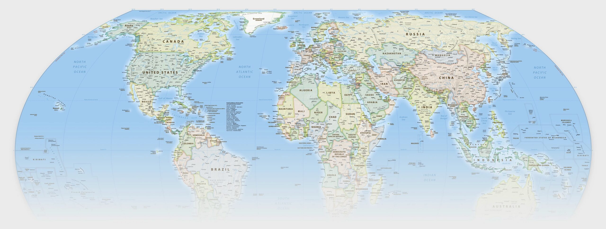
However, converting the spherical surface of the Earth into a flat map inevitably creates distortions. The Mercator projection greatly enlarges areas closer to the poles, while regions near the equator—including Africa and South America—appear relatively smaller.
As a result, Greenland appears nearly as large as Africa on a Mercator map, even though the African continent is about 14 times larger.
The Equal Earth projection, developed in 2018, preserves the correct relative areas of landmasses. Africa therefore appears in its proper proportions compared with Europe, North America and Greenland.
Like every flat map, however, Equal Earth cannot preserve area, shape, distance and direction with complete accuracy at the same time.
France Abandons Mercator
France co-sponsored the resolution, and Foreign Minister Jean-Noël Barrot announced that the country would abandon the Mercator projection for its world maps in favour of representations better suited to their intended uses and more faithful to actual surface areas.
France has chosen the Eckert IV projection, an equal-area design similar in purpose to the Equal Earth projection promoted by the UN resolution.
Barrot said changing a map does not change the world, but correcting a representation that distorts it is already an act of truth.
US Opposition
The United States said it opposed the resolution because it regarded the initiative as an ideological exercise that distracted the General Assembly from more urgent matters of international peace and security.
Togo rejected that argument, describing the issue as scientific and educational rather than political. It said the continued use of distorted maps had symbolically diminished Africa and reinforced an unbalanced view of global geography.
Although the resolution is not legally binding, its supporters expect it to encourage schools, publishers, media organisations and technology companies to reconsider the maps they use—and gradually change perceptions of Africa’s size and place in the world.